- Home
- About
- Stakeholders
- Projects
- Water
- Evaluating reservoir operations and the impacts of climate change in the Connecticut River Basin
- Collaborative development of climate information for the Connecticut River Basin using Shared Vision Forecasting
- Impacts of climate change on the Massachusetts Water Resources Authority water supply system
- Climate information for water harvesting and re-use strategies in urban settings
- Delaware River streamflow reconstruction using tree rings
- Coasts
- Health
- Cross-cutting theme: Climate
- Cross-cutting theme: Vulnerability/Evaluation
- Water
- Library
- Resources
- Seminars
- Contact Us

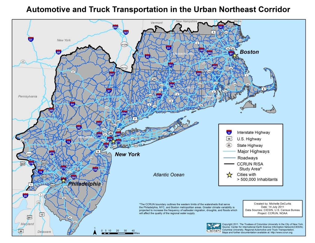
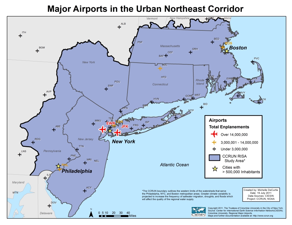
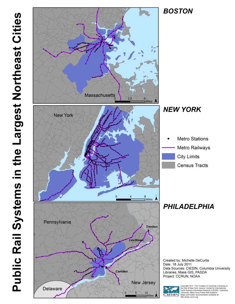
Regional Infrastructure Maps
The maps below illustrate critical infrastructure systems in the urban Northeast region. Most of the region’s low-elevation infrastructure, including buildings, sewage, bridge and tunnel access roads, subway stations, tunnels, highways, and the region’s airports, will be at increased risk of flooding in coming decades. These important components of the region provide and maintain a large-scale public service. In addition to the risk of storm flooding, some coastal transportation facilities may be at risk of inundation as the sea level rises.
Please click on the maps to see a larger version. Printable maps are available at the bottom of this page.
Printable PDF Versions: 
CONTACT US
 > Email